Infrastructure
Utility Poles in GeoGuessr — Read the Roadside Grid
Spot GeoGuessr utility poles, crossarms, and insulators that fingerprint the US, Europe, Asia, and more — a practical roadside infrastructure guide.
3 min read ·
Utility poles are everywhere in Street View — and most players treat them as background noise. Competitive players treat them as a grid fingerprint: wood vs concrete, crossarm layout, insulator style, wire droop, and how poles meet transformers.
This guide teaches a fast scan you can run in the first few seconds of a round, then deepen with KnowYourGeo reviews.
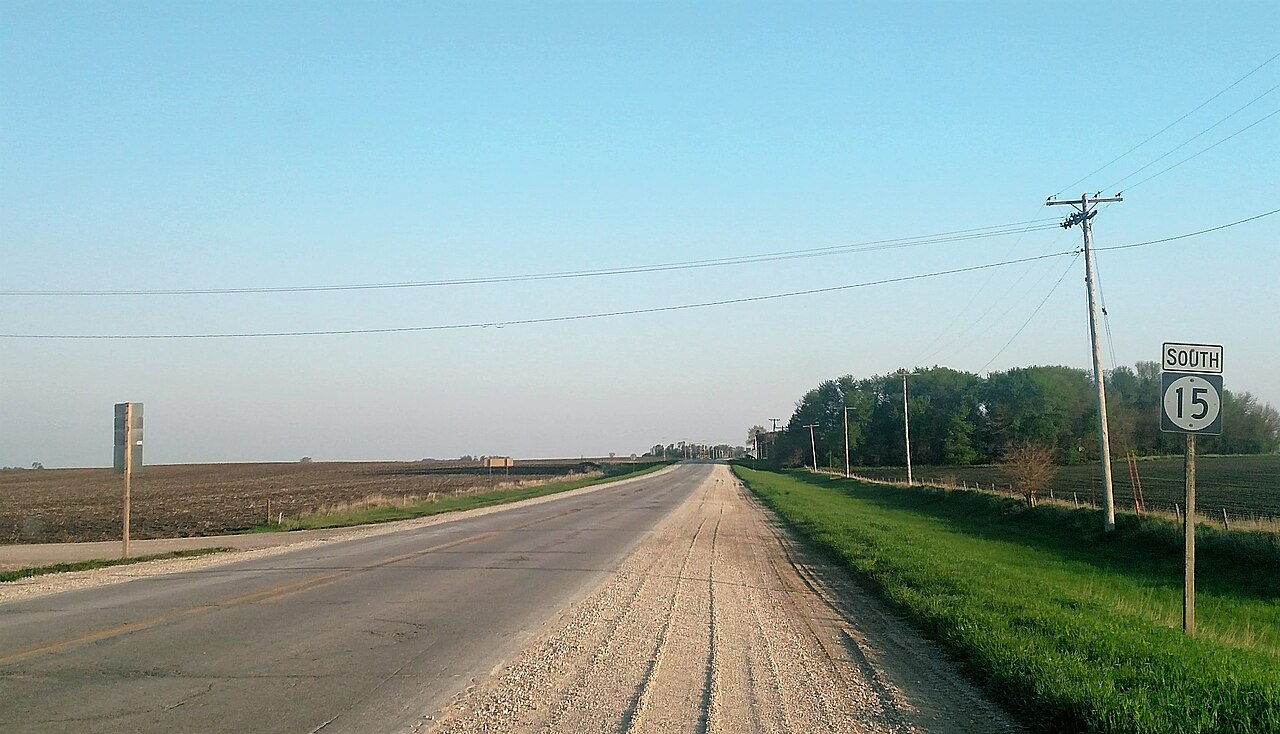
# The 8-second pole scan
When the round loads, glance at the nearest pole and answer:
- Material — wood, concrete, metal lattice, composite?
- Crossarms — none, single, double, asymmetric?
- Insulators — ceramic discs, polymer, clustered, sparse?
- Attachment — wires on top, side-mounted, bundled?
- Skyline rhythm — evenly spaced rural line, dense urban clutter, or absent?
You do not need the full taxonomy on day one. Material + crossarm alone already splits large parts of the world.
# Regional patterns worth memorizing
# North America
Long rural corridors of wooden poles with simple crossarms are extremely common in the US and parts of Canada. Pair with:
- yellow center lines / white edges (context dependent)
- US highway shields or state route markers
- English signage and wide rights-of-way

# Europe
Expect more concrete poles, tighter villages, and denser roadside objects. E-road shields and Latin/Cyrillic script usually arrive with the poles — use both.

# East and Southeast Asia
Poles often sit in denser clusters with complex wire bundles, especially near towns. Combine with left-hand traffic (Japan, some SE Asia), script families, and vegetation (rice, palms, cryptomeria, etc.).

# Arid and desert contexts
Sparse poles, long spans, and open sky change the “rhythm” of the line. If the landscape is desert scrub or red dirt and poles look American, check Southwest US vs Australia vs southern Africa carefully with driving side and soil.

# Poles + road paint = stronger pins
Poles rarely win alone. Stack them:
| Pole note | Add this | Often points toward |
|---|---|---|
| Tall wooden rural line | Yellow center paint, English | US / Canada candidates |
| Concrete urban poles | E-shield / Latin diacritics | Europe |
| Dense complex wiring | Hangul / Japanese / Thai | East / SE Asia |
| Sparse arid spans | Left traffic + eucalyptus | Australia candidates |
# Training plan (one week)
Day 1–2: Whole World, but your only early clue is pole material. Journal what you saw.
Day 3–4: North America continent map — force yourself to notice crossarms.
Day 5–6: Europe + Asia maps — compare concrete vs wood density.
Day 7: Replay AI review notes. Build a one-page personal “pole cheat sheet” with 6 screenshots max.
# Mistakes that waste points
- Staring at poles for 30 seconds while ignoring script on a nearby shop.
- Assuming “wood = USA” every time (many countries use wood).
- Forgetting generation / coverage quirks — some countries have newer camera cars and cleaner poles.
# Bottom line
Utility poles are a rhythm clue. Learn the rhythm for a few regions deeply, then expand. On KnowYourGeo, treat every missed pole call in AI coaching as a free flashcard — that is how infrastructure meta becomes automatic instead of trivia.

.svg)


.jpg)